Top Qs
Timeline
Chat
Perspective
Ogasawara, Tokyo
Village in the Ogasawara Islands, Japan From Wikipedia, the free encyclopedia
Remove ads
Ogasawara (小笠原村, Ogasawara-mura)[2] is a village in Ogasawara Subprefecture, Tokyo Metropolis, Japan, that governs the Bonin Islands, Volcano Islands, and three remote islands (Nishinoshima, Minamitorishima and Okinotorishima).
This article needs additional citations for verification. (March 2017) |
Remove ads

Remove ads
History
In 1940, five municipalities were created in the islands, which had been unincorporated before, two on Chichijima, two on Hahajima, and one on Iwojima.[3]
- Ōmura (大村) on Chichijima
- Ōgimura-Fukurosawa (扇村袋沢村) on Chichijima
- Kitamura (北村) on Hahajima
- Okimura (沖村) on Hahajima
- Iōtō (硫黄島村) on Iwojima (Iōtō), which includes all of the Volcano Islands
Both villages of Kita Iwo Jima became part of the newly created Iwojima municipality in 1940:
- Ishinomura (east)
- Nishimura (west)
Following World War II, the islands were administered by the United States. The islands were returned to Japanese control in 1968 and organized as Ogasawara Village.
Airport plan
In August 2020, the Tokyo Metropolitan Government held a council about a potential airport.[4] It would be operational in 10 years at the earliest.[4] The mayor of Ogasawara Village, Kazuo Morishita said "The airport is the village's long-cherished wish." Governor Koike also said at a regular press conference that day, "(The new model plan) is an effective measure to secure the air routes necessary to protect the lives of the islanders."[4]
Remove ads
Geography
Summarize
Perspective
The municipality consists of the following groups and single isolated islands:
- Bonin Islands (小笠原群島, Ogasawara Guntō), 73.00 km2
- Mukōjima rettō (聟島列島), 6.57 km2
- Chichijima rettō (父島列島), 38.89 km2
- Hahajima rettō (母島列島), 27.54 km2
- Volcano Islands (火山列島, Kazan-rettō) 29.71 km2
- Kita Iwojima (北硫黄島, Kita-Iōtō, lit. "North Sulphur Island") 5.57 km2
- Iwojima (硫黄島, Iōtō, lit. "Sulphur Island") 20.60 km2
- Minami Iwojima (南硫黄島, Minami-Iōtō, lit. "South Sulphur Island") 3.54 km2
- Nishinoshima (西之島, lit. "Western Island"; also known as Rosario Island), a single isolated island west of Hahajima rettō and part of the Volcano Islands, 0.29 km2
- Okinotorishima (沖ノ鳥島 or 沖鳥島, lit. "Remote Bird Island") 0.01 km2
- Minamitorishima (南鳥島, lit. "Southern Bird Island"; also known as Marcus Island) 1.40 km2
The southernmost (uninhabited) group is known as the Volcano Islands. 700 km further south is Okinotorishima, and 1,900 km further east is Minamitorishima.
The population of the municipality resides on Chichi-jima (pop. about 2300) and Haha-jima (pop. about 500). The administration and village hall is located in the village of Omura on Chichi-jima. In addition, there is an air base with 400 soldiers on Iwojima of the Volcano Islands.[citation needed]
Remove ads
Demographics
Per Japanese census data,[5] the population of Ogasawara has remained relatively steady in recent decades.
Education

Ogasawara Village operates the islands' public elementary and junior high schools.[6]
- Ogasawara Village Municipal Ogasawara Elementary School (小笠原村立小笠原小学校) in Chichi-jima
- Ogasawara Village Municipal Ogasawara Junior High School (小笠原村立小笠原中学校) in Chichi-jima[7]
- Ogasawara Village Municipal Haha-jima Elementary School and Junior High School (小笠原村立母島小中学校) on Haha-jima
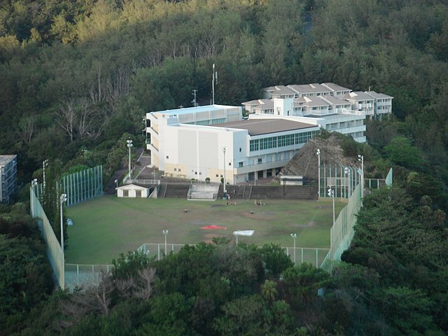
The Tokyo Metropolitan Government Board of Education operates Ogasawara High School on Chichi-jima.[8]
Remove ads
See also
References
External links
Wikiwand - on
Seamless Wikipedia browsing. On steroids.
Remove ads


